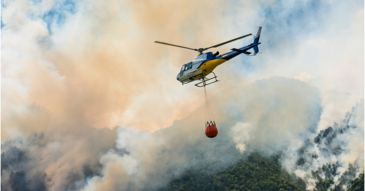

Bambi bucket system used by Aragón’s aerial firefighting fleets
GpsGate, fleet tracking industry leader, achieves ISO 27001 certification
Aragón fire watch program
Aragón’s firefighting teams use GpsGate for live GPS tracking, map integrations, and camera feeds. The platform keeps workers safe while battling active fires.
— Jesús Morcate de la Fuente, Forestry Engineer in Aragón
STOCKHOLM, SWEDEN, July 22, 2022 /EINPresswire.com/ — Wildfires are raging across southern Europe. For fire management teams, access to real-time GPS data is essential. Aragón’s forestry department in northeastern Spain uses GpsGate’s fleet tracking software to support their wildfire management strategy. Live GPS tracking and map integrations help them monitor active burning sites and protect emergency workers.
At present, Aragón’s teams are battling a 15,000-hectare fire surrounding Ateca. With 2,000 people evacuated from their homes, it’s now up to the Natural Environment and Forest Management Department to contain the blaze.
“Geo-positioning in forest fire operations is essential. Without the exact location of our teams, it’s hard to keep them safe. The ability to receive images and video data from our firefighting fleets and integrate it with GpsGate means we can work efficiently in emergencies to save more people and natural resources.”
Aragonesa de Servicios Telemáticos (AST) used GpsGate to custom-build Aragón’s fire watch platform. Via GpsGate Server, fleet managers know the exact GPS location of aerial and ground firefighting crews. Map layers, helicopter video feeds, and points of interest equip control room operators with the right data at the right time.
Remote teams in government and emergency services have secure access to Aragón’s fire watch data. There is little time wasted in dispatching fleet vehicles and enforcing public safety operations like road closures and evacuations. With telematics software via GpsGate, Aragón has the tools they need to keep loss of life and natural resources to a minimum.
About GpsGate
A pioneer in GPS tracking software since 2007, GpsGate’s mission is to make vehicle fleets greener, safer, and more productive. GpsGate’s platform is secure, flexible, and easy to integrate with other business software. Sweden-based GpsGate powers large fleet solutions through its global partner network. Learn more at gpsgate.com
About Aragón Natural Environment and Forest Management
The region of Aragón in northeast Spain is located between the major cities of Madrid and Barcelona. Spanning 50,000 square kilometers, the landscape varies from the mountainous Pyrenees to river valleys, arid steppes, and farmland. Aragón’s fire watch program was custom-built using GpsGate Server and is an instrumental tool in their wildfire management strategy.
Sven Vedin
GpsGate AB
+46 8 612 50 70
email us here
![]()
The content is by EIN Presswire. Headlines of Today Media is not responsible for the content provided or any links related to this content. Headlines of Today Media is not responsible for the correctness, topicality or the quality of the content.